Monday, June 12, 2023

Mills, cemeteries and waterfalls

 52 Saturdays: #9


Uncas Leap at Yantic Falls. There are multiple versions of this story, but in all of them one native warrior makes an impossible leap over a gap here and others fell to their deaths. The plaque says "modern-day erosion" has made the gap larger, but I have my doubts anyone ever jumped it. 


Founders Cemetery has no headstones. There is one large monument in a corner, a bench near the middle and a informational plaque at the entrance. The Thomas Post in the plaque whose land this is built on is Grandpa Joe's ancestor. The first person to be buried there was his first wife, before it was a town cemetery. He is buried there too. 


Take Under the Mountains Road past Plains Cemetery and Franklin Swamp (I saw some very cute turtles here) to Ayer's Gap. This was the first waterfall I went looking for in Connecticut. It has a pretty series of cascades tumbling down Bailey's Ravine. I saw what looked like a drop off and went to the edge to see, but all I could see were trees. It became a theme of my hikes here. Really pretty though. 

Next is Trumbull Cemetery, named after Jonathan Trumbull, Connecticut governor during the Revolutionary War, the only colonial governor that supported the revolution. Josiah Dewey (1641-1732) and Hepzibah Lyman Dewey (1644-1732) are buried here. The Deweys helped found Lebanon and my grandpa, Joseph Hilton, is descended from them. There are also some Revolutionary War sites in Lebanon, including the Trumbull House and the War Office.


Willimantic is not much of a tourist town these days. The main drag has some empty buildings and some of the historic homes are pretty run down. But there are some kind of cool quirky things here. The buildings from the mills are still there, and there's a museum about that history. The Frog Bridge is a quirky attraction, with its giant spindly-legged frogs sitting on top of thread spools on its four corners. 


And just down the street is the Garden on the Bridge, a pedestrian bridge that is planted nicely and offers views of the river, falls and mill ruins. 


UConn Dairy Bar makes its own ice cream from the university's dairy. You can see the cows grazing nearby on Horsebarn Hill that gave the milk used there. Really good ice cream with some great constants and some limited edition and seasonal flavors. 

Sunday, June 11, 2023

Prince Edward Island

 Saturday #8 (road trip)


I wanted to ride a bike in Newfoundland, but that would have been a 15-hour drive and two overnight ferry rides. So I settled for another island province with bike trails that's just a 10-hour drive -- and no ferries, just an 8-mile bridge -- away.


Prince Edward Island is the setting for Anne of Green Gables. So this change of itinerary also got Bettie very much on board. 

I groaned and walked out of our TV room so many times as a kid because my sisters had gotten there first and started the Anne of Green Gables mini series on our only TV. Since then, my worldview has broadened somewhat. I love a couple of Pride and Prejudice adaptations, for instance. And I was once in a book group with a full grown man who told me that Anne of Green Gables was his very favorite book of all time. 

So I was ready to let Anne of Green Gables into my Canada bike trip. We listened to the first book on the way up, and it's fantastic. The manic ups and downs of youth, as told by a perceptive, vivacious orphan girl as she comes of age around the turn of the 20th century. I guess I should have sat down a couple more times as a kid and found out what it was all about. 

We went on Memorial Day weekend, late May during what a local called a "slow spring." Most of the trees were still bare and we were told that the handful of blossoms that were out had just appeared within the last couple of days. The weather was beautiful for us -- highs in the mid-60s and partly cloudy most of the time.


It still looked pretty wind-swept and wintery. Actually, it wasn't just wind. It was Hurricane Fiona-swept. Last September, Hurricane Fiona, the most intense tropical storm to ever hit Canada, came through.


The businesses still looked like it was winter too; most were closed, even on the weekend. We watched the sunset too late the first night and couldn't find any restaurants open a few minutes after 8 p.m. We settled for road trip snacks and waited for breakfast. 

At church the next day, we talked to an old timer who still woke up nervous and early every time he planned to go to the mainland. A little post-traumatic stress from the days when ferries -- ferries that sometimes bumped private citizens at the last minute to let long-haul trucks get across -- were the only way on and off of the island. 

After church, we decided to ride bikes to Robinsons Island, where it looked like there was some dirt to ride. We parked nearby, hopped on the bikes and headed past a road that looked closed to vehicles. Perfect. As we passed a visitor center, I made eye contact with a park employee, we nodded at each other and Bettie and I pedaled up the road. 

He was the last person we saw until we were almost back to that spot. The road got worse, the tree damage was more obvious and it was just us, the birds and the ocean. The road goes out to a loop of bike trails, which were cleared, although some of the "features" like bike see saws and ramps were still under construction. 

It wasn't until we took a short spur to the beach, though, that I decided we probably weren't really supposed to be there. I got off the bike, walked a few steps straight toward the beach and looked down at what I'm pretty sure was the biggest chunk of ancient pottery I've come across. 

I've seen small pieces of decorated pottery in Chaco Canyon (NM) and Grand Gulch (UT), but nothing that chunky. I called Bettie over to see and said, "I don't think anyone is supposed to be in here right now." I left it there, of course, but it doesn't seem like the kind of thing that would just sit on the beach for very long with a bunch of rangers and bikers and hikers coming through every day. 

Sure enough, when we got back, we had to get off our bikes to walk around a barricade that said "No entry" in the exact spot where I nodded at the park employee earlier that morning. He didn't say anything and there's no way both Bettie and I could have missed that thing. However it happened, it was clearly closed. Oops. But it was the best part of the trip.

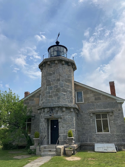
The Anne of Green Gables stuff was fun, for sure. Picturesque cemetery where the author is buried. The church where she played the organ.


The house owned by her aunt and uncle that she chose as the setting for the book is now a museum packed with details from the fictional world -- an old-time vanilla bottle and raspberry cordial among tons of other items on the kitchen shelves, a broach set on an old dresser, a dress with puffed sleeves, etc. 

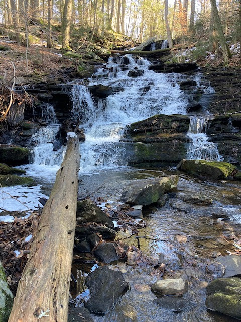
My favorite part of the Green Gables grounds was the Haunted Woods, of course, a set of paths that wind through thick woods and next to little streams. I walked through once with Bettie and we saw a bunch of birds in the thickets -- the Blackburnian warbler was a new one for me, and the yellow-rumped warbler and American redstart were ones I was really happy to see again. Then I went back for another half-hour or so while she made a phone call. 


Friday, June 9, 2023

Stonington

Saturday #7


    Last Saturday, we drove to Stonington. We started out walking at the Dodge Paddock/Beal Preserve. It's a very short trail along the ocean and through a little wetland where they've reclaimed a very old industrial area. There are a few quiet benches facing the ocean. and a trail that winds back away through the wild roses and native plants. There were cormorants on the ocean and a yellowthroat stretching its neck as high up as it could to belt out its song. 


    We were there on a cool Saturday that threatened rain, so I don't know what it would be like on an 80-degree Saturday in July. But this morning, we were one of two people parked at the six-car lot for the preserve, which is in walking distance of everything else mentioned here. There is also maybe 15 parking spots at Stonington Point, but I'm guessing those fill up first and driving all the way down there -- through a mix of one-way streets and very narrow two-way streets -- was a little dodgy. 
    Next, we went to the Stonington Lighthouse Museum. We actually paid an entrance fee and went to the top of the lighthouse. First time since we've been here. The museum was perfectly small.  Just six rooms packed with War of 1812, steamboat and whaling artifacts -- scrimshaw, old flags, uniforms, sailing tools -- and an unaccompanied visit to the lighthouse tower. 


    We walked up to Noah's Cafe. There's a nice little walk along the Stonington Seawall that goes by a pier and a bay. Beautiful. 


    Noah's Cafe was busy but not too busy. I had a great chicken quesadilla and Bettie got a "boro bowl," their version of a Buddha bowl. They some cool photos displayed for sale. Mostly local stuff, like drone shots of Stonington Point and a tree full of cardinals and blue jays, but also classic travel stuff, like an artsy Eiffel Tower and one of those Greek islands with the little homes packed onto the steep hill that leads down to the ocean. 
    Really pretty drive too, especially Al Harvey and Flanders roads on the way into Stonington. 
    Buttonwood Farms Ice Cream is another great ice cream shop. They make their own with ingredients from their farm. 
    Then we checked out Hopeville Pond really quick. It had a crowded campground and a boat launch where you could kayak in the "pond," a dammed up section of the Patchaug River. After looking closer at the map when we got home, I wished I'd checked out the Patchaug State Forest. Looks like there are some dirt roads and boat launches to explore there. 
    Anyway, another great day in Connecticut.


Saturday, March 18, 2023

Mount Watatic, MA

 Saturday #6


Mount Watatic is on the Massachusetts-New Hampshire border, just over an hour north of the Connecticut border. It was a mom and pop ski area until the mid 1980s and it survives as a backcountry destination. I drove up there early on a Wednesday after a storm had dropped more than 2 feet of snow over a couple of days. When I reached the top, another solo skier was on his way down, a pair of skiers were about to head out, and while I looked around and transitioned, another solo skier and a group of four reached the top. 

I started from the trailhead southwest of the summit, but the runs are north facing and most others parked at the alternate parking area on that side, on Bennett Road. That's what I'd do next time, although the 1.1-mile hike from where I parked was straightforward and beautiful, even the slightly tricky stream crossings. 


After checking the forecast all the long, dry, warm winter, it finally looked right up there. So I hit the road at 5:30, drove north mostly on Interstates to the town of Ashburnham. Once I left the freeway, the plows still had some work to do. Half the cars on the road had plows on front, whether they were actively pushing snow or had the plows raised traveling deep ruts en route to their next gig. 

I wasn't sure which parking area to start from. The Mount Watatic Trail was signed and the route was posted. The Ashby Wildlife Management Area from the north seemed like the ticket for a more direct return to the car. I went to the Watatic trail first, looked in at the narrow, snow-covered dirt road into the small parking area and was about 70 percent confident the CRV could make it in and out. There was nothing but a chained van with 6 of the 24 inches on top of it, and a car that could have been there for months or a couple of days -- the whole storm had buried it into an unrecognizable marshmallow. 

While I sized up the driveway, a 4WD Nissan Frontier decided to go for it and bounced in to a parking spot. 

I wondered if the north lot would be better and drove around. There's no Verizon coverage there, so my map wasn't working. I missed one turn, then got back on the way. Then missed another and ended up near the first spot. So I gave up and made it into the first lot, wondering if I would make it out. 

On the way down, I passed two skiers. One of them said, "I hope you're not in a hurry. There's a plow stuck, blocking the exit. He's got a guy on the way."

"I wondered if something like that would happen."

"Well, it happened."

One of those pickups I'd seen driving around with the plow blade on it had taken a crack at clearing out that entrance and gotten his truck wedged between the two snow banks. 

"I got another guy coming to pull me out, but it'll be 30 minutes or so."

"Well, after he pulls you out, maybe he can pull me out."

"He's got a bigger truck than me, we'll get this all flattened out and get you guys out of here."

When the other guy arrived, he said, "Looks like you got yourself into quite a mess here."

"You ain't kidding."

So the one plow hooked up and pulled the other plow out, then took a crack at it and got stuck a few feet further on. It took two tries after that before he made it past my car and I was able to back out to the highway. 

Sweet day, dude.

Friday, March 17, 2023

Hop River x Airline Trail


Saturday #5

The Hop River Trail has plenty of big river views and little streams bounding down to join the larger waterways. Very pretty place to walk or ride a bike. The 20-mile converted rail trail is very easy and mellow. Fun stuff. 


You can pause for lunch at Pho Delight Thai or Willimantic Brewing Company. Then continue onto the northeast half of the Airline Trail for a 45-mile ride. Airline Trail is less scenic, in my opinion, but does have some nice bridges and ponds. 


End at Main Street Gelato in Putnam for some unique flavors of good gelato. After Town Farm Road in Putnam, where the map at the link ends, the Airline Trail gets rougher, but it continues across a bumpy trail, down a hike-a-bike descent, across a bridge over the Quinebaug River and into downtown Putnam. 

Central Connecticut mix tape


 Saturday #4

The route starts at Blackledge Falls, on a Connecticut State Forest. It's a typically beautiful hike -- trees, a creek, some walking bridges, and it's sufficiently rural that if you go early or on a weekday, there should be plenty of parking and solitude. The falls were ok. We went on a cold day when it hadn't rained for a while, so we'll have to go back when there's more water moving.


The route on this map passes interesting colonial homes, winds on the edge of a lovely state forest, passes Old Bull Hill Cemetery one of the small, ancient cemeteries that I love here. 

Then, you'll reach Comstock Covered Bridge, covered in a previous post, it's one of Connecticut's three remaining historic covered bridges. You can walk to Day Pond Brook Falls from here, about 3.5 to 4 miles out and back, or drive to Day Pond State Park to shorten the walk to under 2 miles.


End at Oz N Bones in Colchester, a great barbecue place that has its own blend of Texas barbecue. Then try Mel's Downtown Creamery nearby, open year round. Mel's sells ice cream from the Bliss Creamery in Attleboro, MA, has 7-inches hanging from the ceiling and pop-tab art on the walls. 


Saturday, February 18, 2023

Farmington River

Saturday #3

This one includes maybe Connecticut's best series of waterfalls, a mellow bike path along the Farmington River, a great ice cream shop, a castle, a kayak launch and a couple of great bridges. 

I think a really fun way to do this would be if you had a couple of people that wanted to bike an easy, paved 20 miles -- all on a bike path, with lunch in the middle and ice cream at the end -- and another couple of people that wanted to explore the shops in a quaint Connecticut town (and meet for lunch and then ice cream). 

I did the map in the link as a bike route to show where the bike trail -- from the parking area for the Farmington River Trail at 350 Collinsville Road to the ice cream shop -- goes; driving would be a little different but following a similar route would be great.

Countryside Park in Avon features a couple of ponds and a covered bridge. Nice spot. 

The next stop is a parking area for the Farmington River Trail, a 16-mile alternate path of the Farmington Canal Heritage Trail that (mostly) connects Southington, CT, to the Massachusetts border north of Suffield with paved, bike-only trails. There are a couple of short crushed-stone sections and a few spots where the trail follows small, lightly-trafficked roads, and at least one section that is still in the planning stage. The parking area is at the 3.5-mile mark of this map. The trail from here winds along a beautiful section of the Farmington River. It's wide, rocky, meandering and a slight uphill grade as the current lazes toward you. 


I loved the very long railroad bridge and the mill ruins in Collinsville. If you don't have a canoe or kayak but still want to paddle at Lake McDonough (toward the end of this trip), then you can rent a kayak or canoe for $25-$35 a day here at Collinsville Canoe and Kayak

It's about a 13-mile ride from that parking area to Benny's of Simsbury, a popular, tasty breakfast place in a bustling Connecticut town. 

Eight miles further along, now along the Farmington Canal Trail proper, is Grassroots Ice Cream. There were three of us and we got Goat Cheese and Blackberry, Rose Chocolate, Blood Orange Chocolate, Honey Lavender, Coconut, Cinnamon. They were all amazing. We also sampled (and loved) Raspberry Cheesecake Brownie, Birch Beer, Black Chocolate Peanut Butter Cup and Lemon Bar. Definitely the most unique flavors I've seen around here. 

A few miles west is my favorite set of Connecticut waterfalls, Kent Falls. We went during a rainstorm, which was great because we had it mostly to ourselves and because the falls were really gushing.


A few miles on is Saville Dam, with its gatehouse turret in Barkhamstead Reservoir upstream and the wakeless Lake McDonough just downstream, there is some great sightseeing and some of the most beautiful flatwater paddling around.


This reservoir is on a Farmington River tributary, so to give this post a little more symmetry, let's continue a few miles to where we started -- at a bridge on the Farmington River. This one is called Church Pool Bridge aka Pleasant Valley Bridge.