Saturday #6

Mount Watatic is on the Massachusetts-New Hampshire border, just over an hour north of the Connecticut border. It was a mom and pop ski area until the mid 1980s and it survives as a backcountry destination. I drove up there early on a Wednesday after a storm had dropped more than 2 feet of snow over a couple of days. When I reached the top, another solo skier was on his way down, a pair of skiers were about to head out, and while I looked around and transitioned, another solo skier and a group of four reached the top.

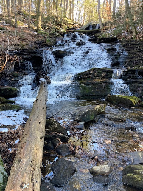
I started from the trailhead southwest of the summit, but the runs are north facing and most others parked at the alternate parking area on that side, on Bennett Road. That's what I'd do next time, although the 1.1-mile hike from where I parked was straightforward and beautiful, even the slightly tricky stream crossings.


After checking the forecast all the long, dry, warm winter, it finally looked right up there. So I hit the road at 5:30, drove north mostly on Interstates to the town of Ashburnham. Once I left the freeway, the plows still had some work to do. Half the cars on the road had plows on front, whether they were actively pushing snow or had the plows raised traveling deep ruts en route to their next gig.
I wasn't sure which parking area to start from. The Mount Watatic Trail was signed and the route was posted. The Ashby Wildlife Management Area from the north seemed like the ticket for a more direct return to the car. I went to the Watatic trail first, looked in at the narrow, snow-covered dirt road into the small parking area and was about 70 percent confident the CRV could make it in and out. There was nothing but a chained van with 6 of the 24 inches on top of it, and a car that could have been there for months or a couple of days -- the whole storm had buried it into an unrecognizable marshmallow.
While I sized up the driveway, a 4WD Nissan Frontier decided to go for it and bounced in to a parking spot.
I wondered if the north lot would be better and drove around. There's no Verizon coverage there, so my map wasn't working. I missed one turn, then got back on the way. Then missed another and ended up near the first spot. So I gave up and made it into the first lot, wondering if I would make it out.
On the way down, I passed two skiers. One of them said, "I hope you're not in a hurry. There's a plow stuck, blocking the exit. He's got a guy on the way."
"I wondered if something like that would happen."
"Well, it happened."
One of those pickups I'd seen driving around with the plow blade on it had taken a crack at clearing out that entrance and gotten his truck wedged between the two snow banks.

"I got another guy coming to pull me out, but it'll be 30 minutes or so."
"Well, after he pulls you out, maybe he can pull me out."
"He's got a bigger truck than me, we'll get this all flattened out and get you guys out of here."
When the other guy arrived, he said, "Looks like you got yourself into quite a mess here."
"You ain't kidding."
So the one plow hooked up and pulled the other plow out, then took a crack at it and got stuck a few feet further on. It took two tries after that before he made it past my car and I was able to back out to the highway.
Sweet day, dude.